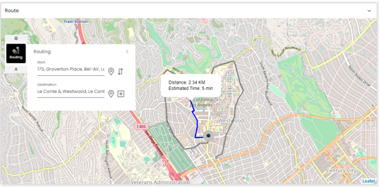
Display shortest route in map widget
You can view the shortest route between two locations and the distance and estimated time to reach the destination in a map widget by using the routing tool. The route is displayed based on the configurations done in Route Configurations of Maps. For more information, see Configure route configurations.
In the Designer Panel, click the Routing icon:

In the routing tool, you can enter the Start and Destination locations and via locations by either dragging the Drag on to map icon
 on the map or entering the name of the location in each of those fields and selecting them from the drop-down that is displayed.
You can add a via point by clicking on the Add via point icon
 and delete a via point by clicking on the Delete icon
  .
.Also, if there are no via points, you can swap the start and destination locations by clicking on the Swap Start & Destination Points icon
 .
.
The shortest route is then displayed on the map between the above configured locations along with the distance and estimated time to reach the destination.
Note
The estimated time to reach the destination is the time taken by a four-wheeler by road.
The example screenshot below shows the shortest route and alternate route between two locations:
